Building Subways has Never Been Easy

subways-of-north-america_516434965cd11_w1500

Toronto is currently undergoing a tumultuous debate about the future of its transit network. Council has debated, approved, and reviewed decisions on Transit City, One City, the Scarborough subway and soon SmartTrack.

Torontonians are justifiably frustrated by the challenge of moving forward and believe that out process of transit planning is broken. We feel as if we are falling behind.

Reading Robert Fogelson’s amazing chapter on Derailing the Subways in his book “Downtown: It’s Rise and Fall, 1880-1950,”  I was struck out how much the challenges of modern day transit building mirror those of the past.

We have an image that subway building was extremely productive in the early 20th century in North America. But unlike large European cities, very few North America cities invested in a rapid transit network, when downtown reigned supreme and urban densities were at their peak. As Fogelson writes:

“by the late 1920s, after more than two decades of vigorous efforts, after the preparation of scores of studies and reports, after the expenditure of millions of dollars, and after a host of predictions that most big cities would soon build a rapid transit system, nearly 90 percent of the els, close to half of which had gone up before the turn of the century, were in New York and Chicago. And more than 90 percent of the subways were in New York and Boston, both of which had begun to build their first underground lines before 1900.”

The map above really demonstrates how mass transit in North America is concentrated in just a few cities. Over a dozen cities studied building transit in the early 20th century, including Toronto, yet very few did.

Why? One reason was that subway advocates were  strongly divided over the question of why, where, and how to build subways. Was it relieve traffic congestion or promote residential dispersion? Should the system be built incrementally or all at once? How should cities pay for the transit? By taxpayers, property taxes, or special assessments? Why should only downtown benefit from subways, while other parts of the city would not benefit from the investment?

The issue of how to pay for subways was significant. The costs involved were astronomical even then, when compared to streetcars and elevated rail networks. Very few cities had the revenue tools, or desire to pour so much capital into subways, especially cities that lacked the density of New York, Boston, and Chicago.

There was also a significant cultural shift in the early 20th century. The ultimate solution to traffic congestion in North America was not to improve and invest in rapid transit but to spread the city. There was a powerful idea that the “cure” to congestion was to decentralize. Contemporaries looked to New York and believed subways only make congestion worse by funnelling people into a dense core.

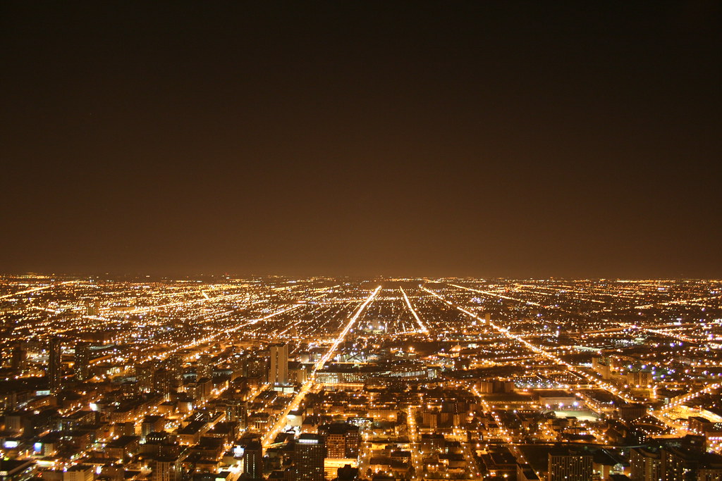
But Los Angeles points a way forward for cities like Toronto. Los Angeles tried to build a decentralized metropolis, it didn’t work.

In the 1990s, Los Angeles began the subway project it abandoned 70 years before. In 2008, Los Angeles residents approved a 30-year, 0.5-per cent regional sales tax that pour $40 billion into transportation projects. Currently the City has six major transit projects underway including a subway line, four light rail lines, and a bus rapid transit way.

If there is one thing that history can tell us it is that mass transit was never an easy sell in North America. It takes considerable investment, long-term planning, and commitment across city regions. Hopefully, our 21st century efforts, led by Los Angeles and hopefully Toronto, will be better than those at the beginning of the last century.

The Recession has Changed the Geography of Growth

14417978556_52ab246806_k

The great recession appears to have had a significant affect on how North America’s major cities are growing. Since 2009, more growth is happening in walkable transit oriented communities than on the edges of metropolitan areas.

Christopher B. Leinberger & Patrick Lynch, from the George Washington University School of Business, have tracked growth in major cities the United States and have found that growth patterns have shifted significantly since the recession. For example,

“Both Metro Miami and Atlanta sprawled faster than most metro areas for decades. In this real-estate cycle, which began in 2009, these two metros indicated a fundamental shift from drivable suburban office development to walkable urban, as their [walkable neighbourhoods] are rapidly increasing their share of the office market.”

The same trends observed by Leinberger and Lynch in the United States can be observed in Toronto. People increasingly want to live in walkable neighbourhoods. The Pembina Institute in a recent survey found that an astounding 81% of people in the Greater Toronto Area would prefer to live in a neighbourhood where they can walk to stores and had frequent and reliable transit service.

This stated preference is playing out in what is happening on the ground. Construction has shifted from the drivable suburban developments to walkable urban development. For example, over the last four years, over 40% of all new units were built in the city of Toronto, a significantly higher percentage than at any time in the last 30 years.

GTA-Toronto Completions

Downtown Toronto has become the fastest growing area in the Greater Toronto Area. Between 2006 and 2011 downtown grew at four times the rate of the rest of the city of Toronto.

In addition to the significant amount of residential development, there is 5.2 million square feet of office space being built in downtown Toronto, which is slightly less then one-third (31%) of all office space currently under construction in all of Canada. This is a significant change from the early 2000s when downtown Toronto was experiencing almost no office growth. CBD Office Space Construction

Five years is not a lot of time. Yet, it is becoming clear that in Toronto, and across North America, the geography of growth has fundamentally shifted. People want to live in neighbourhoods where driving is a choice and where you can take transit or walk to work. These people are now transforming the geography of growth in the Greater Toronto Area, and across North America.

“It’s going to be St. James Town all over again”

St. James Town

If you ever want to strike fear into a Torontonian about the current high-rise construction boom tell them their neighbourhood could be the next St. James Town, a low-income high-rise neighbourhood on the east side of downtown Toronto.

Predicting what community will become the next St. James Town is a well discussed  topic on online forums such as UrbanToronto and Skyscraper City and in papers such as the Grid Star, and Globe and Mail. The general consensus is the neighbourhood most at threat of becoming like St. James Town is CityPlace.

CityPlace is new community of high-rise towers rising out of the former rail yards on Toronto’s waterfront. As Ivor Tossel mused, predicting that it’s going to be the next St. James Town is as old as CityPlace itself. Even the wikipedia article on CityPlace makes mention of the comparison.

Despite the ominous quotes and fear mongering, would it really be so bad if CityPlace had more in common with St. James Town?

Before rejecting the idea outright it’s worth recognizing that St. James Town is a pretty successful and vital place. It’s less like St. Louis’s Pruitt-Igoe and more like 1950s Kensington Market, a vibrant immigrant settlement area.

As Doug Saunders explains in his book “Arrival Cities” gateway neighbourhoods like Kensington and St. James Town are vital for the success of immigrants and for cities.

“[Immigrant neighbourhoods] benefit from [their] tight clustering of poor, foreign residents: this helps [them] function as an instrument of integration, a platform for urban inclusion … [It’s] a springboard or gateway community where people settle for a couple of years while they get a job, and then they move on. [Immigrant neighbourhoods] appear unchangingly poor and segregated only if you fail to observe the trajectory of each resident. And for half a century, those trajectories have generally been upward.”

St. James Town remains one of the few pockets of relatively affordable housing for families in downtown Toronto where new residents get a shot at beginning their lives in Canada. In a city region where 80,000 immigrants settle every year this is important.

St. James Town is also safe. Crime rates are close to the Toronto average.

Looking at the statistics this neighbourhood is no more dangerous than the neighbourhoods of Mimico or High Park North. Meanwhile CityPlace’s Waterfront neighbourhood is perhaps one of the most dangerous in the city, likely due to the presences of the entertainment district.

Crime Rates

If CityPlace became an affordable downtown neighbourhood, where new Torontonians could afford to settle with their families as they prepare for their lives in Canada, Toronto would be better off.

So instead of wondering how CityPlace can avoid the fate of St. James Town, we should look at how can we find ways to bring the best of both places together.

E-Commerce and Land Use

20140810-132854-48534722.jpg

Most people don’t equate e-commerce with land use planning, but as more people shop online it is going to have a huge impact on our cities. For example, North America is undergoing a massive boom in warehouses and “fulfilment centres.” As the Economist writes:

Such modern structures usually lie within 100km (60 miles) of a big city and are near sea- and airports, highways and sorting hubs for couriers like FedEx and UPS. They are much bigger than older types of warehouse: often more than 100,000 square metres (1.1m square feet, or 14 football pitches); and they have high ceilings to further increase their volume. At Dotcom Distribution’s cavernous New Jersey warehouse, pickers ride “reach trucks” up to three storeys above ground to fetch 50,000 different products for 15 e-commerce clients. Such fulfilment centres also employ far more people than older warehouses: around Christmas each may have up to 3,000 staff working on shifts.

We can already see how the rising demand for fulfillment centres is playing out at the local level in British Columbia where there is a brewing battle between conservationist and developers for land.

The Globe and Mail reports that the demand for new industrial land required in British Columbia’s Lower Mainland is already far more than what is available. Paul Tilbury, the Chief Operating Officer of an industrial developer in the Lower Mainland argues that demand for industrial land can’t be served “by intensification or telling distributors to go to Kamloops or Calgary, as local politicians have suggested. A lot of the new demand comes from the e-commerce section. “They measure their success in delivery time,” Mr. Tilbury says. That means they want to be as close as possible to the big population centres.

E-commerce is going to significantly affect land use policy as we grapple with preserving agricultural land and reducing sprawl. It is also likely to create a mismatch between retail space and industrial space. We’ll need fewer stores and more storage. Will this mean that eventually big box centres will be converted to warehouses? It’s hard to say, but what is clear is that fulfilment centres are becoming an integral part of the economy and will shape the future geography and economy of cities and regions.

Who Lives Where?

I’ve always been interested in how researchers sort and label neighbourhoods. That is why the University of Toronto’s Cities Centre report, Eight Canadian Metropolitan Areas: Who Lived Where in 2006?, caught my eye. The report uses statistical analysis to pin down what kind of common neighbourhood “types” exist in Canadian cities.

Looking at the maps below, it’s obvious that the authors found cities that are far more complex than the urban/suburban view of cities would suggest.


The authors identified six broad neighbourhood typologies in Canadian cities:

  • Older Working Class, generally found in the inner suburbs;
  • Urban/Suburban Homeowner, located in stable residential areas constructed after 1945;
  • Old City Establishment, situated in older high-income, inner city areas associated with gentrification;
  • Young, Single, & Mobile Renters, which are found downtown;
  • Disadvantaged Groups, exhibit the most complex and diverse clusters around city regions; and
  • Family Ethnoburbs, which are found in the suburbs of only four of the cities studied.

The researchers use these typologies to highlight the complexity of social geography in Canadian cities.  A scan of the maps reveals quickly that the social geography of Canada’s largest cities is more complex than that of its smaller cities.

For example, the city regions that are attracting the countries  most immigrants, Toronto, Montreal, Vancouver, Ottawa, and Calgary,  also have a unique neighbourhood typology called the “Family Ethnoburbs.” The Ethnoburbs are located in newer neighbourhoods on the cities edges.  The existence of this typology is a powerful indicator urban growth over the last two decades has become critical for our big cities to attract global talent and the importance of new housing to accommodate growth and attract immigrants.

What I find most interesting is that these maps are not static. Twenty-five years ago we would not have had Family Ethnoburbs, or an identifiable group of Young, Single, Mobile renters located downtown.

It will interesting to see how this social map of Canadian cities will change over the next twenty-five years. These categories are very much a product of Canadian cities today (do American cities have similar ethnoburbs?). The social structure and population of our cities is constantly changing, so these maps provide an interesting perspective of our complex and always changing city regions.

Take a look at the full report here.


Is Vaughan a Suburb?


Is Vaughan a Suburb?

What is a suburb? This is a question that I often explore in this blog and was tackled by the Globe and Mail’s public editor, Sylvia Stead.

A resident of Vaughan wrote to the Globe arguing that Vaughan is not a suburb of Toronto but instead a city in its own right with a Mayor, and asked the paper to  print a correction. This led the Stead to ask:

So can you establish a rule for the use of the word suburb? Do we avoid the word when referring to cities, but not to towns or villages? Does this apply more to Toronto and the Greater Toronto Area than to other municipalities in the city?

Stead soon found out was that it was not a simple question, which reflects why over the last fifty years researchers, writers, and many others have grappled with defining suburbs, cities, and the places in between.

The Globe and Mail’s stylebook listed the suburbs of Vancouver in great detail as well as those of Montreal more generally, but was silent on Toronto’s (perhaps the book needs updating?). So what did Stead conclude after consulting the stylebook, dictionary, and her colleagues? She thought,

the description could have been “Vaughan, a suburb north of Toronto” or “Vaughan, a city north of Toronto. Both of those wordings are better because they do not suggest that Vaughan is part of Toronto, as in the original “the Toronto suburb of Vaughan.”

Yet, Ryerson University politics and public administration professor Myer Siemiatycki was able to convince Stead that perhaps Vaughan could be described as a suburb of Toronto. Siemiatycki’s argument was that,

“Its location, land use, auto reliance, socio-cultural texture and attachment to Toronto (they cheer for the Leafs, they rise and fall with Toronto’s economic condition) – all these qualify Vaughan and other neighbouring municipalities as Toronto suburbs.”

None of these descriptions is wrong, but they each evoke strong social and economic assumptions about a place, which is perhaps why the reader from Vaughan reacted so strongly to the Globe’s description.

Generally I feel it’s important that we move away from the  urban/suburban dichotomy because our urban areas have become far more complex then the simple urban/suburban narrative suggests.

Therefore, I would suggest describing Vaughan as a city within the Greater Toronto Area. This removes the offending word, suburb, but also firmly attaches Vaughan to the geographic, social and economic texture of the Toronto region.

Your thoughts?


A Jane’s Walk: Estonian Architects and Their Buildings in Midtown Toronto

20 Prince Arthur, Designed by Uno Prii's and Harry Hiller

20 Prince Arthur, Designed by Uno Prii and Harry Hiller

On Sunday, the Estonian Studies Centre  hosted its first Jane’s Walk, “Estonian Architects and Their Buildings in Midtown Toronto“.  The walk, led by  Toronto Architect Käbi Lokk, was an excellent sample of Estonian architecture in Toronto’s Annex and Yorkville neighbourhoods.

During the walk, we looked at the work of four Estonian architects who fled their occupied homeland in the late 1940s. These architects have had a tremendous influence  on Toronto’s postwar architectural style and midtown Toronto.

The pioneer of this group was Mihkel (Michael) Bach. Bach studied architecture in Berlin before the Second World War. In 1949, while living in Sweden, he met a visiting professor from the University  of Toronto’s School of Architecture. The professor encouraged Bach to come to Toronto to join the faculty of modern architecture, which was still in it’s formative years. Bach brought a modernist architectural style from Western Europe to Toronto and is said to have played an important role in the design of Victoria College’s Wymilwood Residence.

Bach would also recruit another Estonian architect with a modernist Scandinavian style, Ants Elken to the University of Toronto. Elken would teach architecture at the University for 33 years. Unfortunately, while Bach had some significant influence on modernism in Toronto in the 1950s, he struggled with personal issues and faded from the Toronto architectural scene in the early 1960s.

However, many Estonians followed Bach and Elken to the University of Toronto School of Architecture in the 1950s, including Uno Prii,  Elmar Tampõld, and Henno Sillaste, whose buildings Lokk highlighted during our walk.

Uno Prii graduated from the University of Toronto in 1955. Prii’s imaginative buildings are often described as “Space Aged,” and have been recognized by many architects today for their uniqueness. The City of Toronto named 13 of Prii’s buildings to to the  Inventory of Heritage Properties in 2004, including 20 Prince Arthur Ave., pictured above.

Also well known, but perhaps not as celebrated are the works of Elmar Tampõld, who graduated from the University of Toronto in 1953. Working with his firm Tampõld and Wells, he was involved with numerous projects along Bloor Street West. These include the brutalist Senator David Croll apartments and Tartu College, both near Spadina and Bloor. Tartu College remains a centre for Estonian cultural life in the city and is a major student residence.

The Senator David Croll apartments, formally know as  Rochdale College, are infamous. As the nexus of hippy culture and later drug culture in the late 1960s and early 1970s the building has become an important cultural landmark. 

While I was familiar with both Tartu and the David Croll apartments, I was unaware of Tampõld’s connection to the Colonnade Building, a luxury mixed-use building along the “mink mile“.

The building was one of the first significant mixed-used projects in Toronto and perhaps Canada. The Toronto’s Star’s architecture critic, Christopher Hume, nicely summarizes what makes the building such an innovation,

“What lifted the Colonnade above the modernist orthodoxies that homogenized the face of cities around the globe was its deep sensitivity to context. A two- and three-storey podium runs along Bloor, which means a continuous streetscape, a critical element in this heavy shopping environment. It also connects Bloor to the open green space behind and Charles St.

Most of the Estonians on the tour who grew up in Toronto during the 1960s fondly remembered the Colonnade and its Estonian confectionary Amjärve. The store apparently once occupied the same space that is now home to Cartier.

During our tour we also took a look at 1132 Bay Street, which was designed by Henno Sillaste, who graduated from the University of Toronto in 1960. 1132 Bay Street was a condominium built in the 1980s. While not a remarkable building, Sillaste was a well known as an expert in curtain-wall systems.

In one of those great examples of how immigration influences both the host country and country of origin,  Sillaste introduced the curtain-wall system to Estonian architects in the 1990s. As a result, the curtain wall is known as a Kanada sein (Canadian Wall) in Estonia.

Lokk ended our tour by discussing a more recent vision to raise the profile of Estonians in Toronto and preserve the legacy of the first generation of the community. The Centre for Estonian Studies is planning a Museum of Estonians Abroad (VEMU), which would be built as an addition to Tartu College.

The museum and archive could be part of the cultural corridor that stretches along Bloor from University Avenue to Bathurst Street and includes the Bloor Hot Docs Cinema, Royal Ontario Museum, and other cultural centres such as the Native Canadian Centre of Toronto . Thomas Tampõld, Elmar’s Tampõld son, designed the proposed addition to Tartu College. An excellent example of how a second generation of Canadian-Estonian Architects are now making their mark on midtown Toronto.

Museum of Estonian's Abroad (Väliseesti Muuseum - VEMU)

Rendering of the Proposed Museum of Estonian’s Abroad (VEMU)

Suburban Growth in Ontario’s Mid-Sized Cities

IMG_1172

Photo by Samuel Bietenholz

Mid-sized cities are having trouble keeping people downtown and encouraging denser living. The Martin Prosperity Institute issued a report analyzing growth patterns for  six Ontario cities: Kingston, Kitchener-Waterloo, London, Windsor, Hamilton, and Oshawa. They found the following:

From 2001–2006 (this is the most recent data available for community profiles) most of the population growth taking place in these municipalities occurred in outer suburbs.


Percentage of population change, 2001-2006 by area.  Source: Martin Prosperity Institute

Percentage of population change, 2001-2006 by area. Source: Martin Prosperity Institute

Even more discouraging for urbanists is that the report found that in the five year period, the population of these city centres and inner suburbs was declining. The author concludes:

This discovery runs counter to the provincial policy put in place to stem sprawl in the past decade, and indicates that something is awry with Ontario Smart Growth policy implementation.

While these findings are interesting, I wouldn’t rush to judge the Smart Growth policy implementation. The Growth plan was only implemented in 2005. Looking at data from 2001-2006 would therefore not have captured any significant changes in growth patterns caused by the Growth Plan. Growth patterns take decades, not years to change, and many municipalities only implemented new growth plans in the last four years.

Yet, I wouldn’t be surprised if Ontario’s mid-sized cities will continue to grow outward instead of upward. There are several reasons for this. First, mid-sized cities tend to be far less dense compared to large urban centres. Therefore, the amenities and employment opportunities commonly associated with density in larger cities are less likely to exist.

Lower densities also mean that public transportation systems in mid-sized cities tend to be far smaller and less convenient. Congestion is relatively mild and commuting by car is quick and convenient. Commute times in these six cities averages 24 minutes (Toronto is 33)  and only an average of 8% of people get to work using transit. Because most commuting is by car, employment and shopping is centred around locations that are easy to get to by car, not downtown. This encourages growth at the fringe were land is cheap and accessible and makes attracting jobs and residents to mid-sized downtowns far more challenging.

While I wouldn’t rush to judge the outcome of Ontario’s Smart Growth policy in mid-sized cities, it is clear that the challenges facing Ontario’s mid-sized cities in promoting smarter communities and reducing auto dependence are significant.

Get Ready For a Planet of Suburbs

Photo by urbanfeel

The planet is going to need a lot more room for cities and suburbs. The Lincoln Institutes’s report on “Making Room for a Planet of Cities” illustrates this vividly. The report  examines where and how quickly cities have and will grow in the past, present, and future.

One of the most interesting findings is that cities all around the world are becoming less dense. In fact, average global urban densities peaked in 1894! Densities have been falling for a very long time, and many decades before the car really began to dominate.

However, not only are densities falling, but cities are growing. Almost three billion people are expected to move to cities by 2050, doubling the number of people in cities globally.

The Lincoln Institute estimates that anywhere between an extra 600,000 to 2.6 million square kilometres of land will be urbanized by 2050, up from 600,000 square kilometres today.

Looking at those numbers and the history of urban growth the authors conclude that because so many global cities are growing very quickly, growth boundaries, like green belts, are a bad idea. They may work in the rich and slower growing places, but in regions where the population of cities is expected to double and triple they make no sense. Greenbelts would only make sprawl worse by forcing people to move outside the green belt creating a city that would sprawl even more. 

One surprising recommendations for a Toronto reader to note is that the authors suggests that Toronto, a city with one of the largest greenbelts in North America, is a model for responsible sprawl because the city has grown along a regular grid of arterial streets. The report says:

For an arterial grid to function as the road network for a public transport system three conditions must hold: (1) residential densities must be sufficiently high to sustain public transport; (2) the roads need to be spaced not more than one kilometer apart, so the great majority of people can walk to a bus stop from any location in less than 10 minutes,… and (3) the width of the rights-of-way for the roads needs to be on the order of 20–30 meters.

The model:

Toronto is one city that has been able to build and maintain an effective public transportation system that extends along an arterial road grid far into the suburbs, and it now boasts the third-largest transit system in North America

Toronto a model for global suburban growth? What do you think?

Comparing Density in Cities

LSE Cities is an ambitious project focussed on how the design of cities impacts society, culture and the environment. As part of their mandate they are releasing some visually compelling work, like the  chart below. 


2011_chw_2050_01


I enjoy the program emphasis on highlighting the diversity of cities and built form around the world. The chart above is an excellent sample of how each cities unique topographical constraints, systems of public transport and infrastructure, and traditions of urban culture and development shape residential densities. As LSE Cities writes

Density differs widely, from the high densities of Hong Kong, Mumbai and central areas of Istanbul and Shanghai to the much lower density pattern of London. Johannesburg shows limited areas of higher density set around a downtown that no longer has a residential population, in the midst of a very low-density sprawl. Istanbul, New York and Hong Kong show how topographical constraints drive densities that rise to ‘spikes’ in Manhattan and parts of the Bronx, Brooklyn and Queens in New York, and in Hong Kong Island and Kowloon in Hong Kong. São Paulo is multi-centred and similar in its overall density pattern to Mexico City, yet São Paulo’s skyline is dominated by high-rise apartment blocks, while Mexico City’s is consistently low-rise, demonstrating that high-density can be achieved with different types of built form.

Looking forward to seeing more from LSE Cities project.